
– –– ––––
––– – ––– – –– –– ––––
––– – ––– – –gray land formation
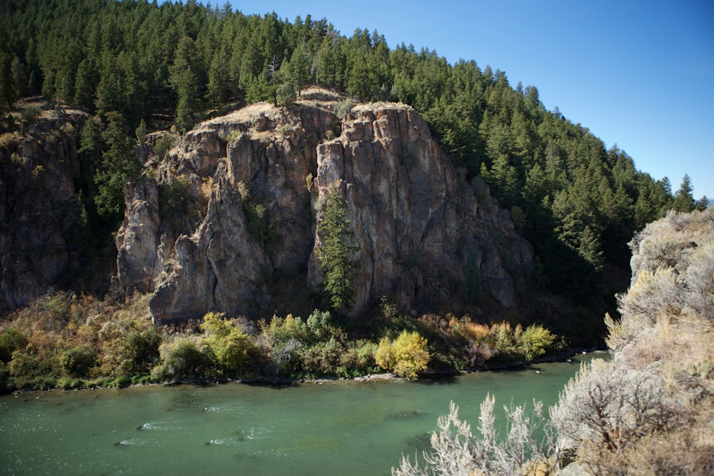
Basalt cliff seen here was noted in journals by early explorer John C Fremont. Bear River, seen at left, flows northward from Bear Lake on the Utah-Idaho border, wraps the tip of the mountain seen here, then turns south and west before emptying into the Great Salt Lake. This is the Great Basin - west of the Continental Divide, but no water reaches the Pacific Ocean. Just beyond this point, the California Trail parts southwest while the Oregon Trail continues northwest. This is the northern terminus of Wasatch Mountains.
Browse premium related images on iStock | Save 20% with code UNSPLASH20
Related collections


Spring
25 images · Curated by Klemen Kastelic


For a Noble Purpose
52 images · Curated by Kelsey Gietl