
grass satellite illustration
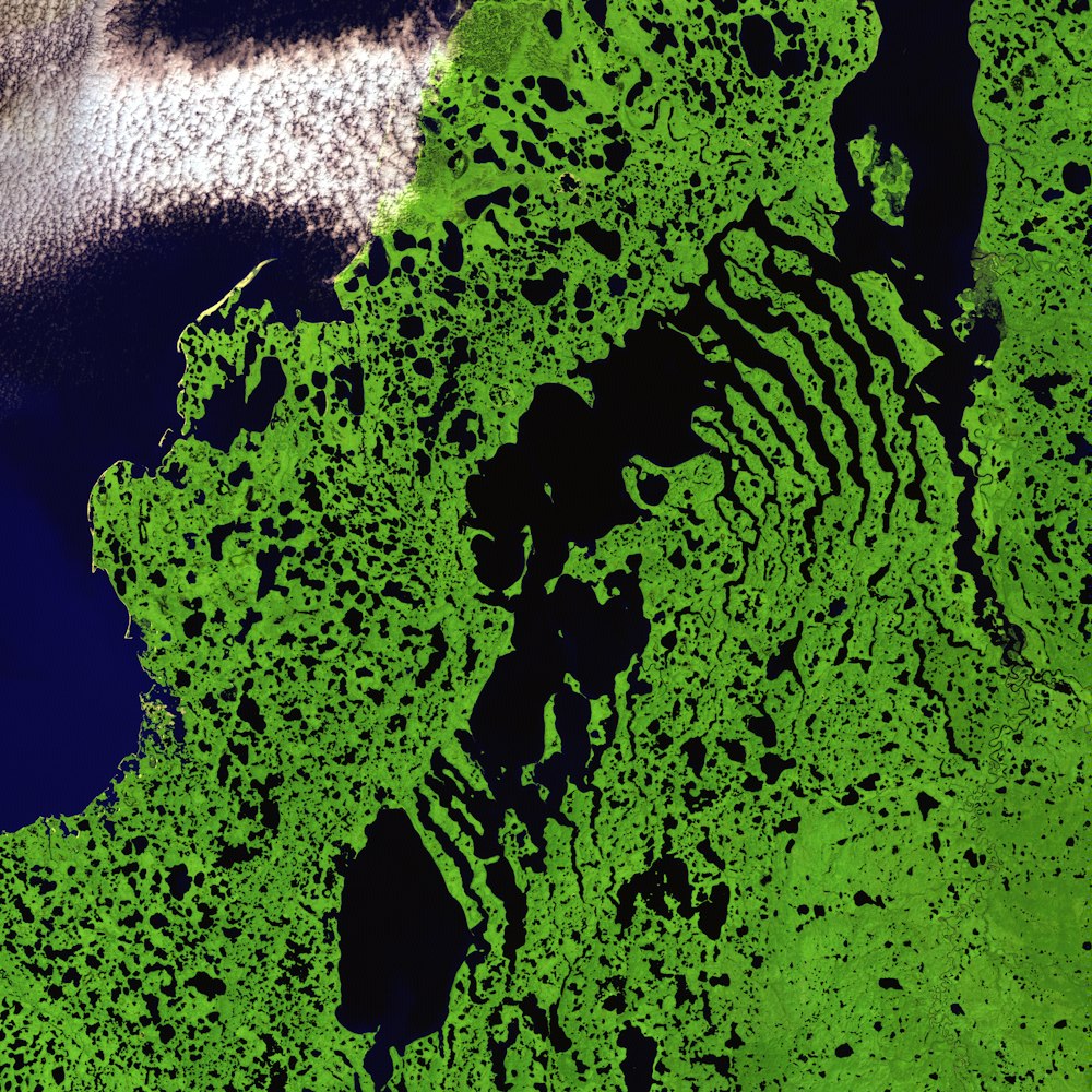
Skeletal extensions of land reach like bony fingers across a section of Liverpool Bay along the northern edge of Canada's Northwest Territories. Only small villages are thinly scattered in this remote and inhospitable region of Arctic tundra bordering the Beaufort Sea. The relatively flat landscape is dotted with shallow lakes during the extremely brief summer season.
Browse premium related images on iStock | Save 20% with code UNSPLASH20
Related collections


Satellite Imagery | Remote Sensing | Earth Observation
117 images · Curated by Mahdi Shakhesi


USGS - Climate journal
140 images · Curated by Vla Stanojevic


