
– –– ––––
––– – ––– – –– –– ––––
––– – ––– – –brown and white city map
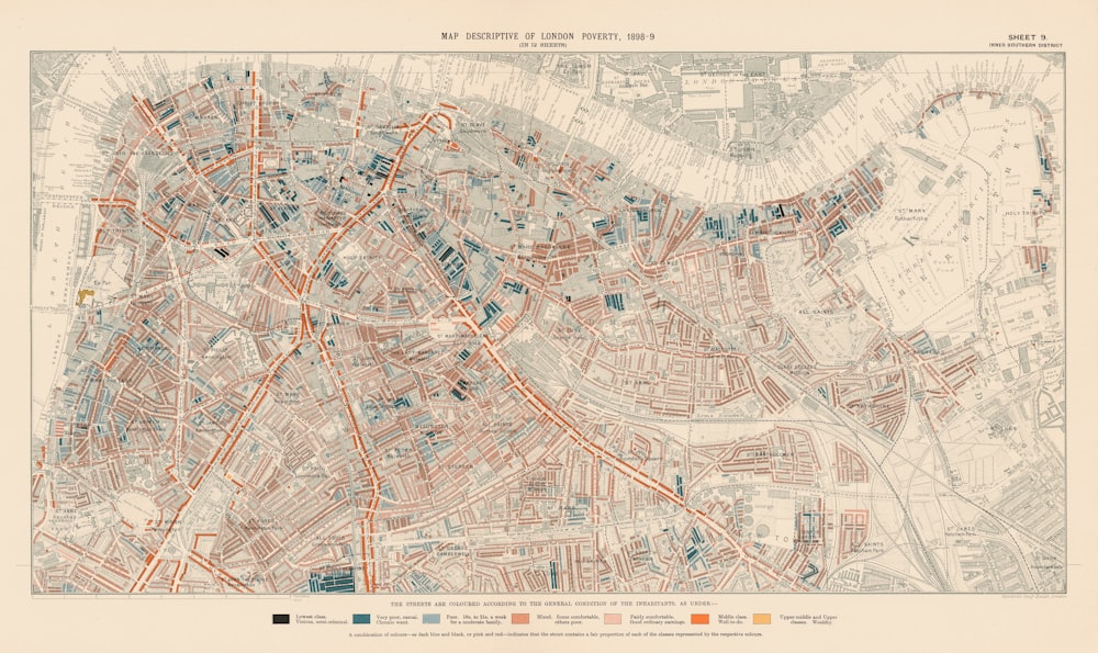
London Poverty Map, 1898-9. Sheet 9: inner southern district.
Published on Free to use under the Unsplash License
Browse premium related images on iStock | Save 20% with code UNSPLASH20
Related collections


Sophie
80 images · Curated by Natalie Brewin


Christmas 2023
20 images · Curated by Suzanne Fox