Unsplash logoUnsplash HomeA photoPen Tool
A compassA stack of foldersDownload
Bookmark
Person
Get Unsplash+Log in
Go to USGS's profile
USGS
usgs
Edit image Plus sign for Unsplash+
Download free
an aerial view of a river and land
โ€“โ€“โ€“ โ€“โ€“ โ€“โ€“
โ€“โ€“โ€“ โ€“โ€“โ€“โ€“ โ€“โ€“โ€“โ€“
โ€“โ€“โ€“ โ€“โ€“ โ€“โ€“
โ€“โ€“โ€“ โ€“โ€“โ€“โ€“ โ€“โ€“โ€“โ€“

Featured in

Photos

an aerial view of a river and land

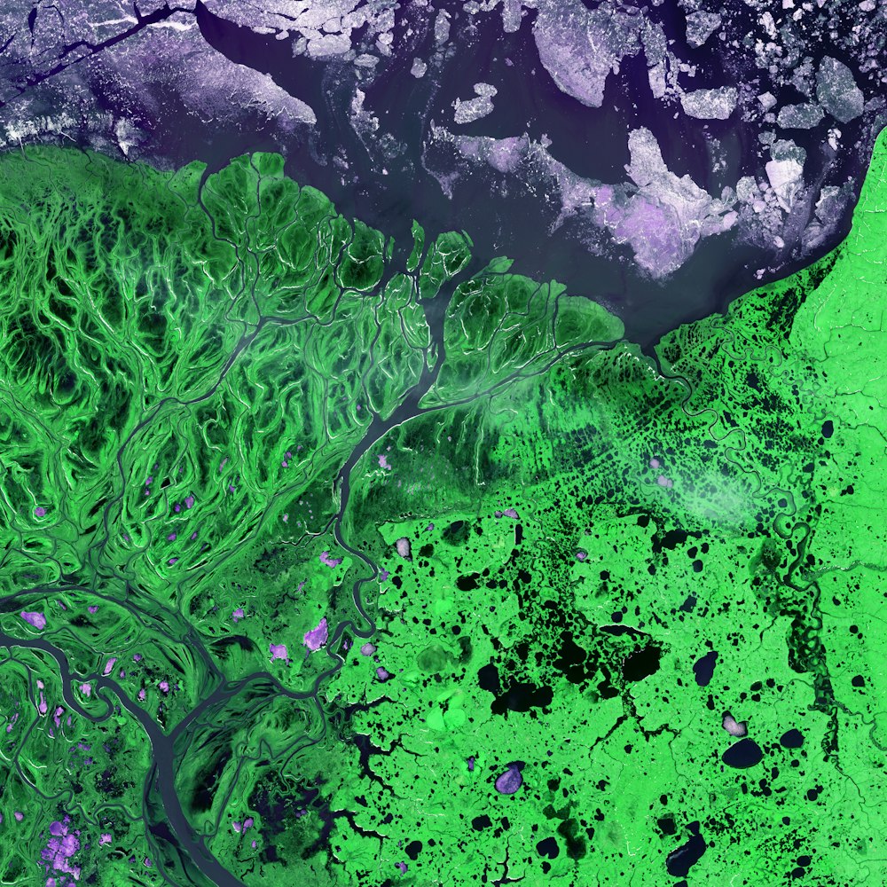
An intricate maze of small lakes and waterways define the Yukon Delta at the confluence of Alaska's Yukon and Kuskokwim Rivers with the frigid Bering Sea. Wildlife abounds on the delta and offshore where sheets of sea ice form during the coldest months of the year.

A map markerYukon Delta, Alaska, USA
Calendar outlinedPublished on January 9, 2020 (UTC)SafetyFree to use under the Unsplash License
abstract1,000,000+ Free Imagesearthweatherclimate changeearth wallpaperclimatesatellitegeographylakesclimate crisisyukonfrom aboveearth from aboveimagerygeographicallandsatmeteorologicalwaterwaysgreenHDR images

Browse premium related images on iStock | Save 20% with code UNSPLASH20