
– –– ––––
––– – ––– – –– –– ––––
––– – ––– – –aerial photography of rice field
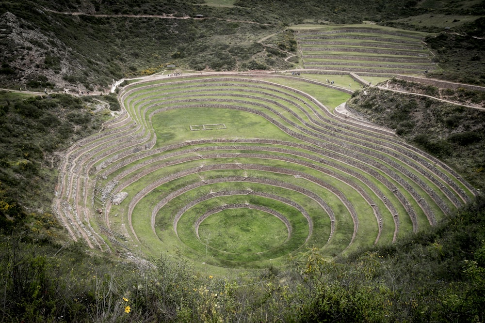
The full purpose behind these concentric terraces isn’t fully known. However, it is widely believed that the ruins were once an agricultural laboratory used by the Incas. The circular terraces that lie here are thought to have been used as an agricultural research station. Their depth, design, and their orientation with regard to the sun and wind are all telltale signs that they have a specific purpose. Because of the different conditions at each level of the terraces there is a difference in temperature of 15 °C (27°F) from the top to the bottom.
Browse premium related images on iStock | Save 20% with code UNSPLASH20
Related collections


travel
1,515 images · Curated by Grant Nicholson


Indigene Menschen
31 images · Curated by Christian Häusler