
– –– ––––
––– – ––– – –– –– ––––
––– – ––– – –aerial map
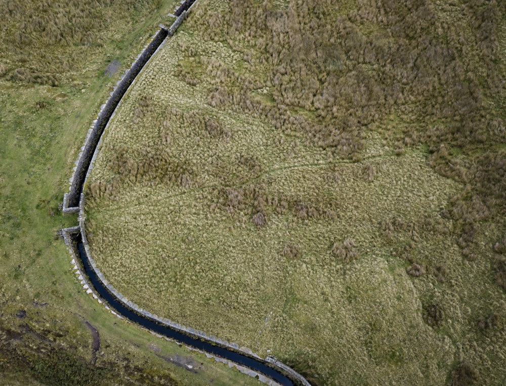
I regularly walk my dog across the moorland at Oxenhope and I’m always fascinated by the conduits that transfer water from reservoir to reservoir across the area. From the sky they create some awesome leading lines and really break up the landscape in an interesting way.
Browse premium related images on iStock | Save 20% with code UNSPLASH20
Related collections

Divine Mother Earth
67 images · Curated by Gabby Orcutt


Unsplash Editorial
8,159 images · Curated by Unsplash


Field Trip Supply
54 images · Curated by jack faulkner